
Utah SNOTEL Snowpack Update report. This is a table showing all Utah SNOTEL sites organized by river basin or geographic area. Scroll to the bottom for the Southwestern Utah stations.
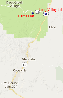
Harris Flat Snowpack SNOTEL graph
Long Valley Junction SNOTEL graph
NRCS operates two SNOTEL sites near the headwaters of the East Fork of the Virgin River - Harris Flat at elevation 7792 feet and Long Valley Junction at elevation 7465 feet.
Powered By:
